March 24, 2025
The Environment Agency (EA) released updated flood risk assessments in December 2024, incorporating enhanced data and modelling techniques to reflect the impacts of climate change.
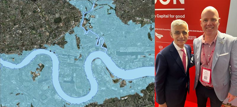
Detailed and more precise flood-risk maps incorporating the latest UK Climate Projections and based on updated high-resolution terrain information of 2m or finer resolution, are now available to the public. These assessments indicate that 6.3 million properties in England are currently at risk of flooding, a number projected to rise to 8 million by 2050. (Source: Financial Times).
On a positive note, The Environment Agency's new maps will help unlock potential development sites in the UK by providing clearer, more precise flood risk data. By updating outdated flood zone classifications and incorporating the latest climate modelling, these maps will allow developers to identify areas suitable for construction with greater confidence. Previously, some sites were incorrectly categorised as high-risk due to broad flood assessments, limiting development opportunities. The improved maps will refine these designations, potentially reclassifying some locations as viable for housing and commercial projects. This can streamline planning approvals and reduce costly flood mitigation requirements. Additionally, local authorities and developers will have better insights into sustainable drainage solutions and climate resilience measures, ensuring safer, more environmentally sound developments. By offering a more accurate understanding of flood risks, the new maps will support the UK’s housing and infrastructure goals while balancing environmental protection and economic growth.
In April, Richard will be discussing with City Hall how we can use BACA’s Planning principles, developed for DEFRA, to unlock these sites to help deliver much needed housing in Greater London.
March 3, 2026

February 18, 2026
February 4, 2026

January 22, 2026
January 15, 2026

December 18, 2025