January 22, 2026
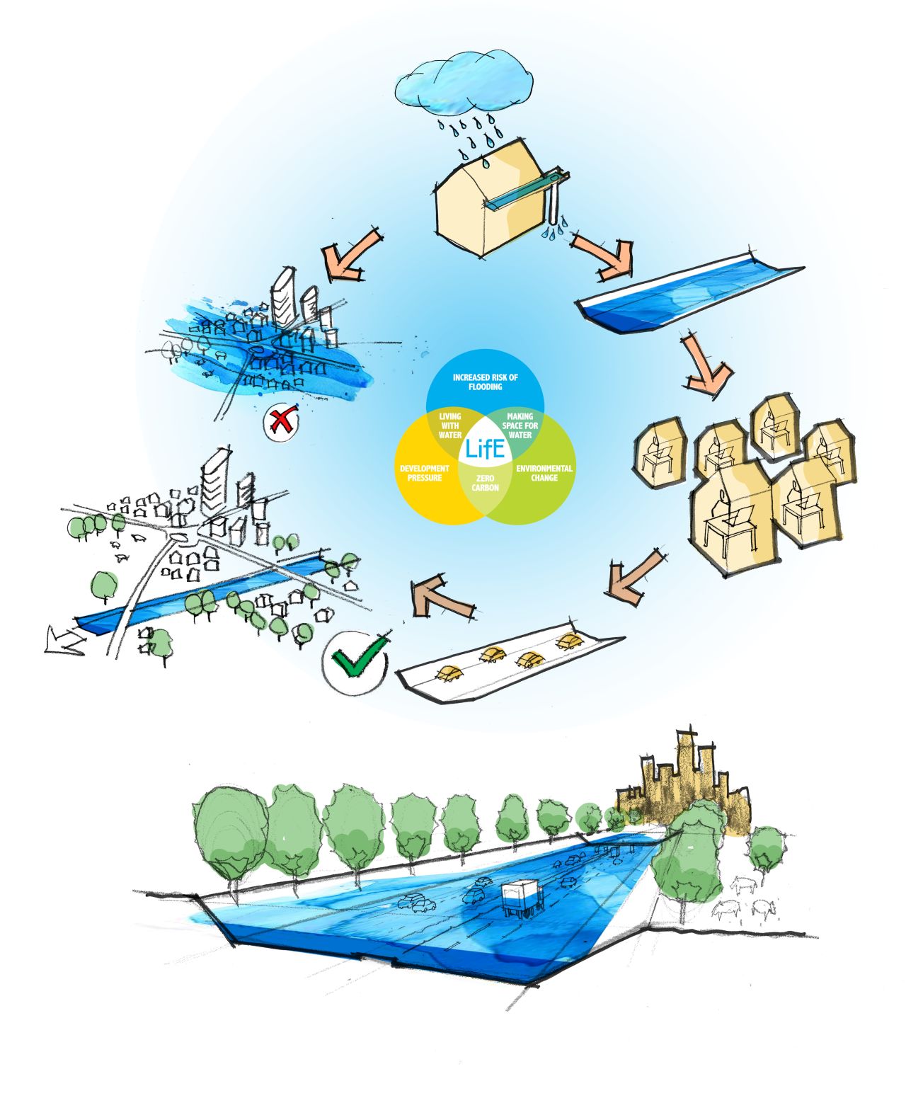
Our response is to explore the potential multi-use of existing assets.
A motorway and a rain gutter share a similar profile.
Both are long, engineered surfaces designed to move water.
The question is simple: could sections of motorway act as temporary flood infrastructure during extreme weather events?
Remote working changed what is possible.
Government signals a flood warning and ‘Work From Home’ instruction. Cars remain at home too!
Once closed, a motorway could operate as an oversized drainage channel.
Floodwater would be directed into defined sections, retained and redistributed.
Following this event, the road would be cleaned and reopened.
The technical challenge is not the barrier.
Policy is.
The current Highways Act demand many roads stay open, regardless of circumstance.
Identifying a network of potential roads and revisiting this policy would open a new flood asset.
One proposal is a new classification: the ‘W Road’.
A road designed to be used in two circumstances.
Serving as both a transportation route and a flood asset.
This will require coordination between the government, highway authorities, and local councils.
It would also require data.
Sensors, monitoring, and clear communication systems to manage closures and warnings.
W Roads aligns with the emergence of smart cities, with foundations serving multiple uses to boost efficiency and sustainability.
Several routes already suggest themselves as pilots.
The M5 in the Southwest and the A2 corridor between Gravesend and Strood.
Both routes have a history of flooding.
Nearby infrastructure allows for efficient traffic diversion.
The M5 runs through areas in the Southwest that are prone to surface water flooding.
The stretch between Junctions 13-15 features raised verges (between Itchington and Rudgeway).
There is a strong network of A-roads, including the A38 and A370.
Which offer practical east-west routes during scheduled closures.
Stretches of the A2, near Bexley and Darenth Country Park, also show potential.
Running along embankments opposite marshland and low-density housing.
Making it a strong contender for stormwater retention or redirection into natural basins.
Like the stretch of M5, there is a strong diversion network with the M2 andA226/A289.
By treating roads as spatial systems rather than single-purpose assets, flood management becomes more resilient, adaptable, and integrated.
The W Road reframes highways as part of the water system, rather than separate from it.
March 3, 2026
February 18, 2026

February 4, 2026

January 15, 2026

December 18, 2025

December 11, 2025