
.avif)
Location: Paris
Client: Mayor of Paris
Status: International invited competition of 10 teams
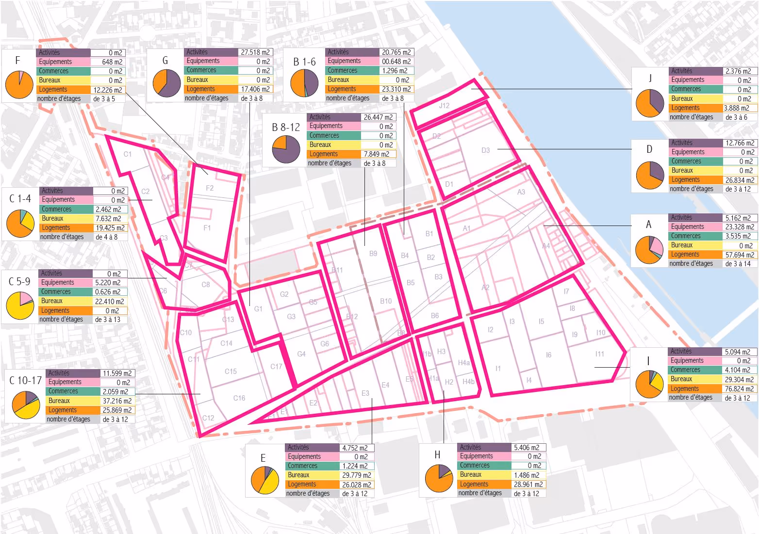
Scale: 37 hectares adjacent to the River Seine, 6.5 million sq ft masterplan for 4,500 homes.
Constraints: Flood zones 2 and 3, brownfield industrial site, multiple land ownership
Scope of Works: Concept design, masterplan, phasing strategy, flood mitigation strategy
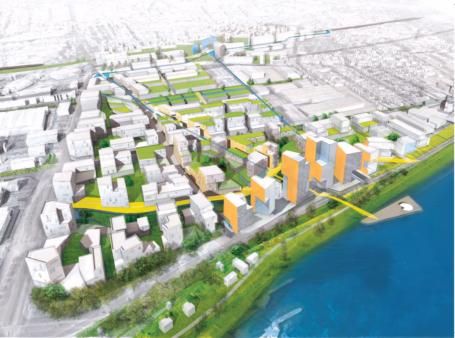
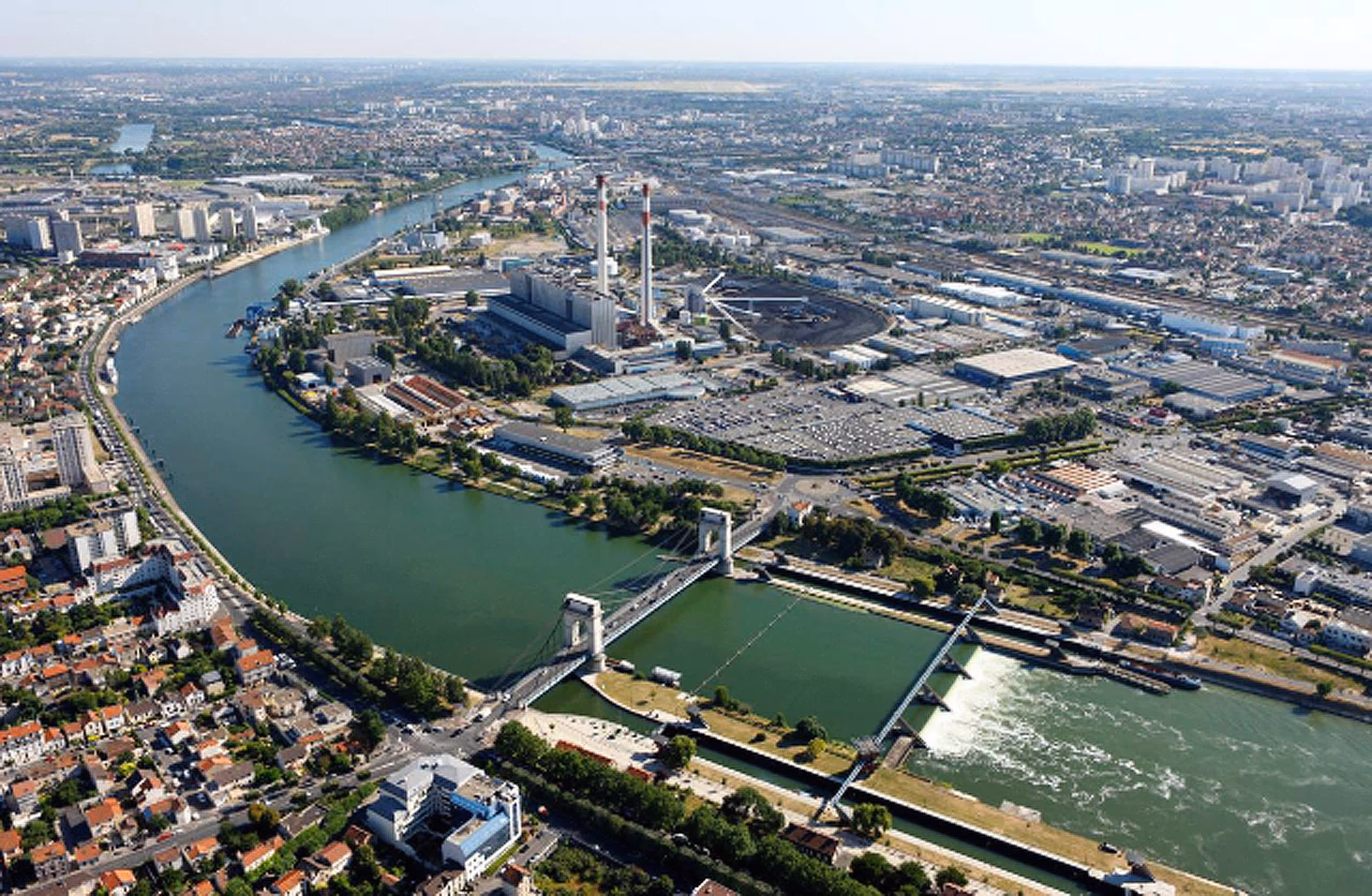
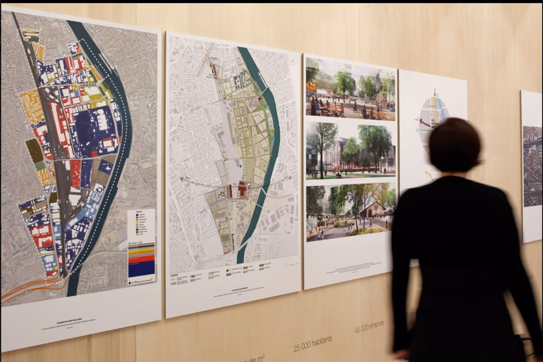
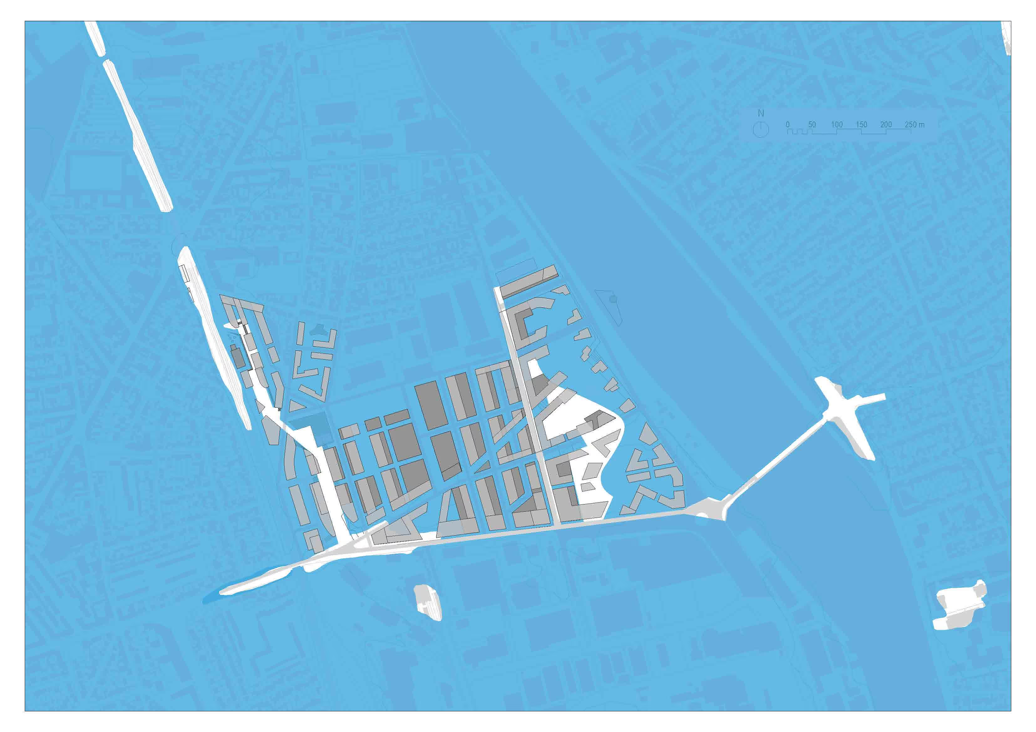
BACA architects have developed an ambitious masterplan for ZAC Seine Gare Vitry, a 37-hectare site along the River Seine just outside central Paris.
Designed to revitalise an area at risk of flooding, the scheme sits within the larger 300-hectare Ardoines development, one of France’s most significant regeneration projects.
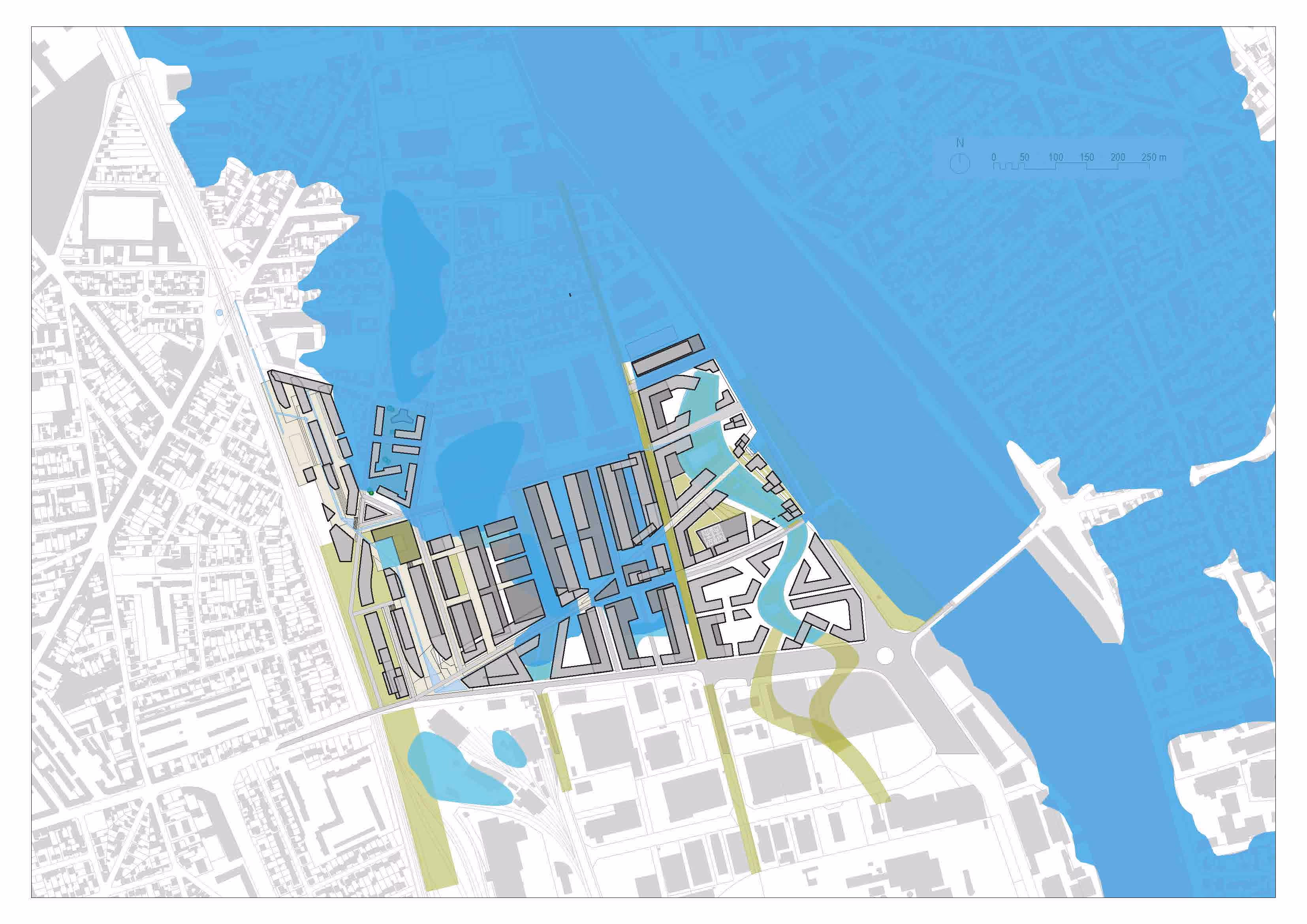
The vision centres on water and nature, creating a vibrant new riverside district that blends living, working, and leisure spaces.
The project aims to deliver over 6.5 million sqft of habitable space, including approximately 4,500 new homes, while retaining the area’s strong industrial and economic character.

.avif)
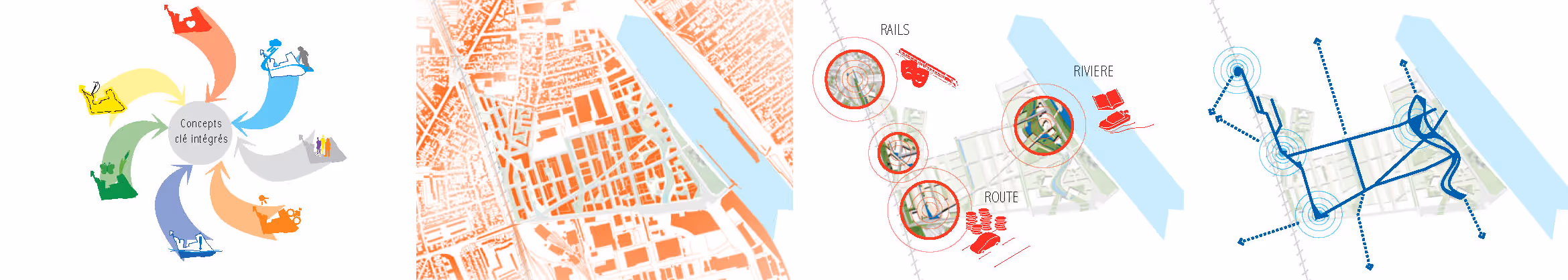
This strategy tackles the site’s complex flood-risk, contamination, and infrastructure challenges holistically, ensuring the development is safe, resilient, and adaptable.
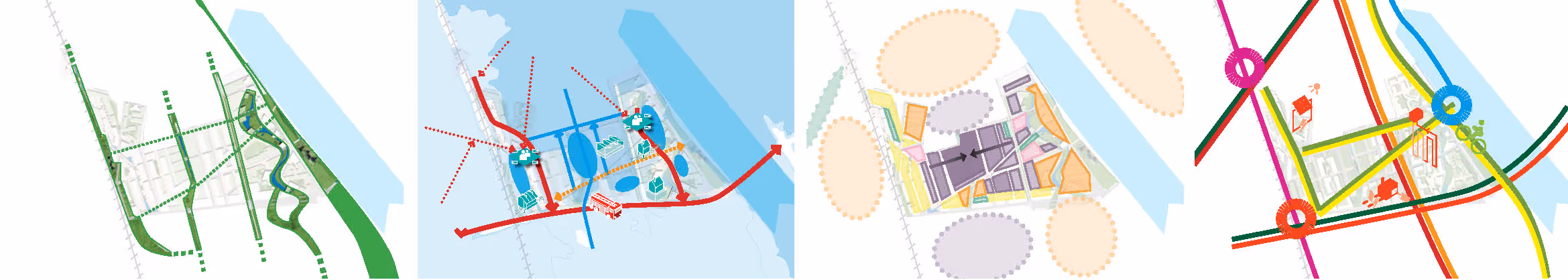
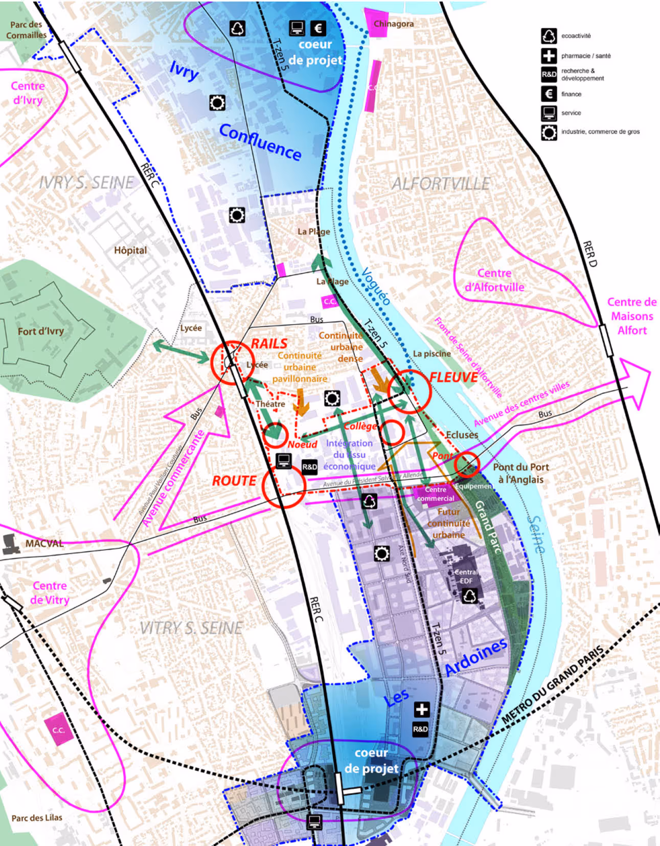
In collaboration with French partners Atelier Villes & Paysages and Egis France, BACA created a layered urban framework structured around three key transport“nodes”: Rail, River, and Road, each acting as catalysts for regeneration.
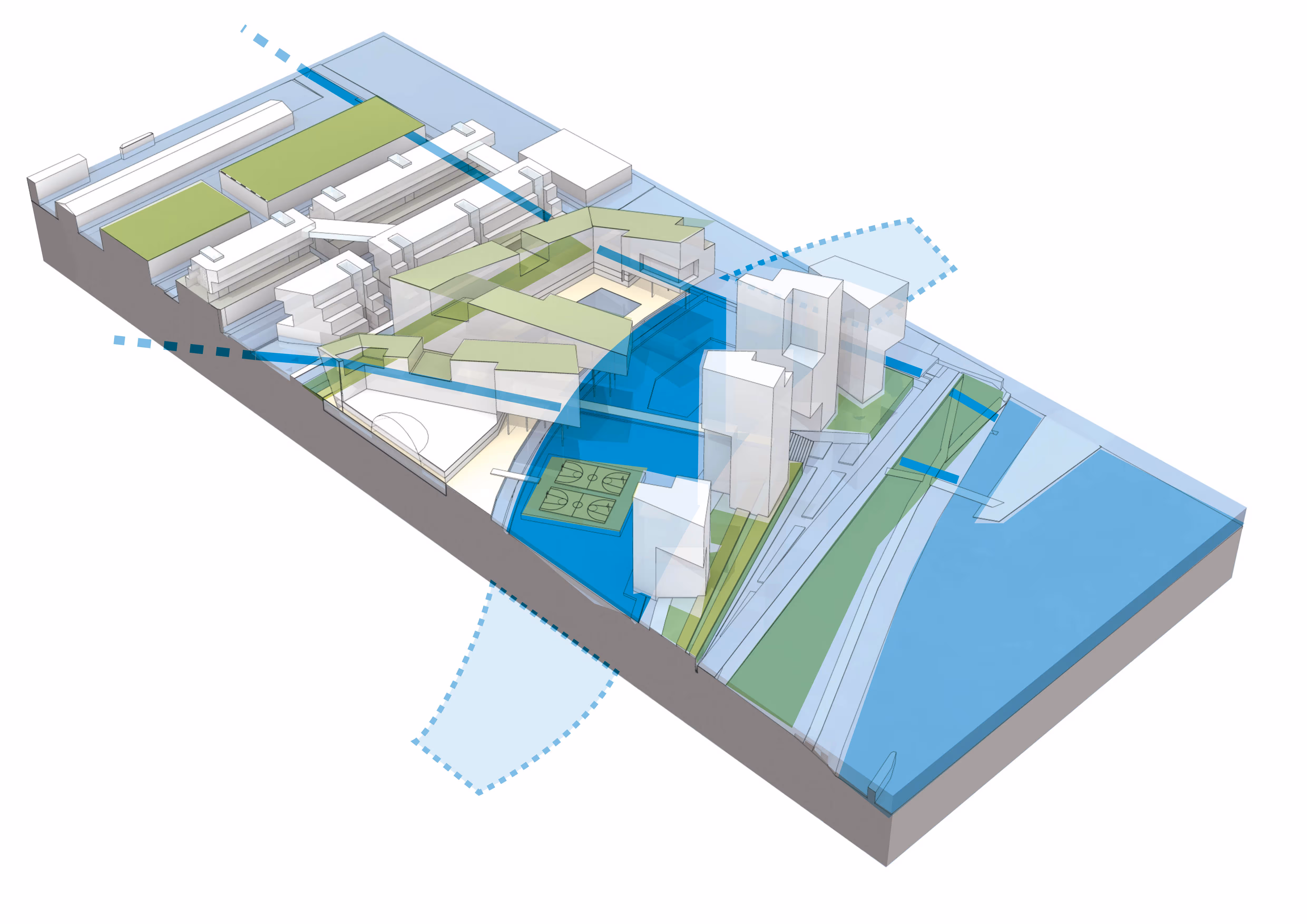
These hubs are linked by a network of blue/green corridors that integrate water management, biodiversity, and movement across the site.
The masterplan’s design also balances competing demands: accommodating floodwater, high-density development, renewable energy, and public amenity, without resorting to costly flood defences.
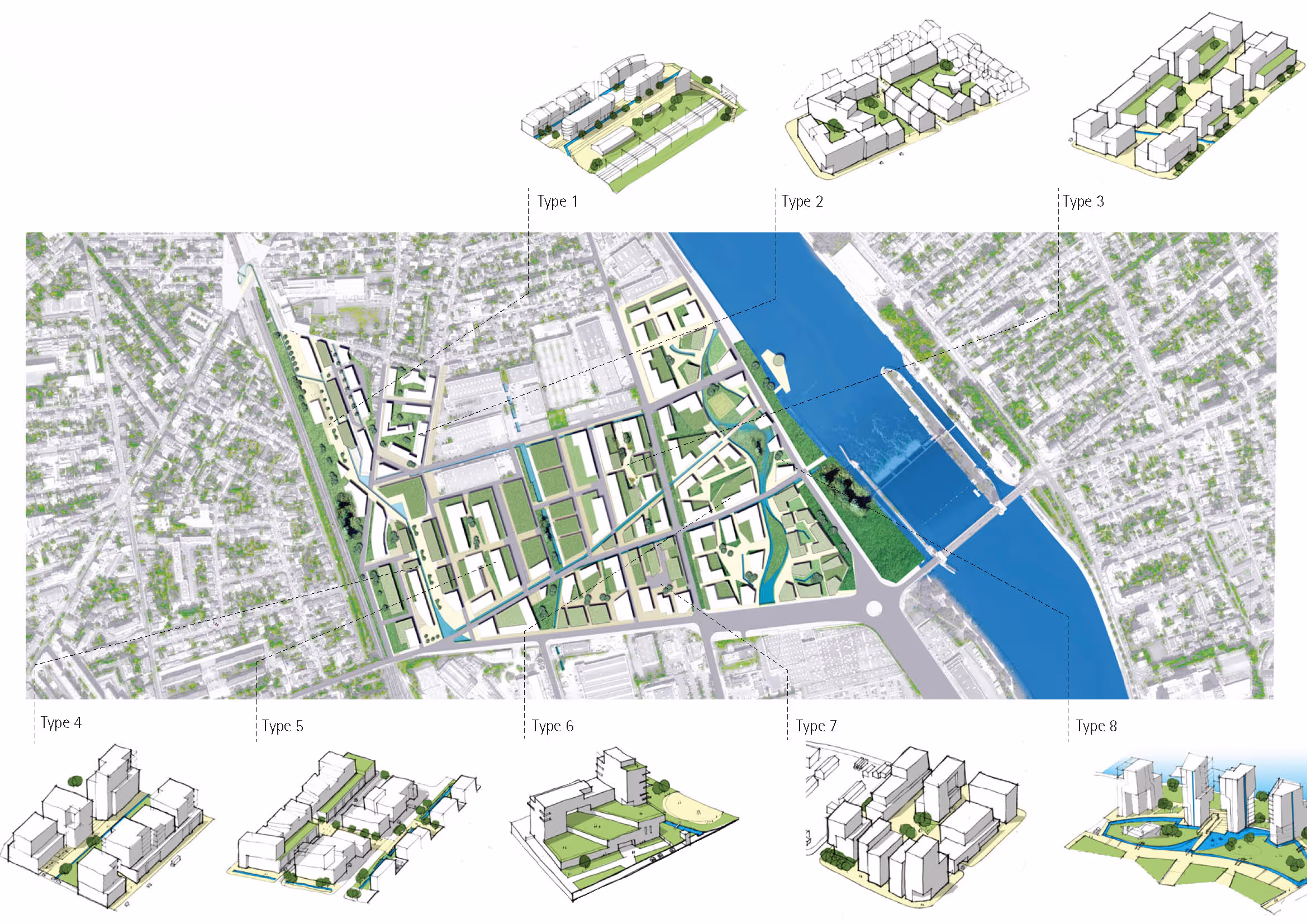

Inspired by the site’s industrial, railway, and riverside heritage, the architectural vision combines contemporary design with strong contextual references.
Water plays both a symbolic and functional role, forming the backbone of the urban landscape through rills, swales, pools, and flood parks that manage runoff and enhance the public realm.
These waterways converge at the key nodes, forming “rain squares”, mirror ponds, and floodable parks that celebrate the river’s presence while ensuring safety during extreme weather.
The masterplan illustrates how flood-risk design can generate identity, amenity, and resilience rather than simply relying on defensive barriers.
By “making space for water,” BACA’s proposal demonstrates a forward-thinking model for climate-adaptive urbanism, one that transforms a challenging site into a thriving, sustainable, and connected riverside community.